Place Names of New Brunswick: Where is Home? New Brunswick Communities Past and Present
 Introduction |
  Alphabetical Listing |
  County Listing |
  Indexes |
  Definitions
 Skip Navigation Links
Located 3.16 km NW of
Saint-François-de-Kent:
Wellington Parish,
Kent County: William Francis Ganong identified the Mi'kmaq name for Bouctouche as Chebooktoosk or "little great harbour": PO from 1829: in 1871 "Buctouche" had a population of 500: in 1898 it was a sub-port of entry and the terminus of the Moncton and Buctouche Railway: Bouctouche also had 1 post office, 12 stores, 4 hotels, 1 butter factory, 1 grist mill, 1 sawmill, 2 carding mills, 1 boot and shoe factory, 1 tannery, 3 smelt packing plants, a quarry, oyster beds, 4 churches and a population of 800: Bouctouche was incorporated as a village in 1966 and as a town in 1985: Bouctouche is the birthplace of author Antonine Maillet.
Latitude
:
46° 28'
Longitude
:
64° 43'
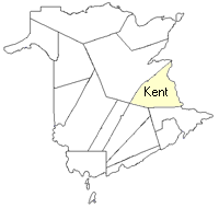
County
:
Kent
Parish
:
Wellington
County location in province

 County map showing parishes
 Zoom in

Cadastral Maps
New Brunswick cadastral maps show the basic features of the province along with the boundaries, lot number, and grantee’s name for land granted by the province. These maps are cumulative, showing all grants regardless of date.
Zoom in

or
download
the full size version.
3616 x 2749 - 2.1 mb
|