Place Names of New Brunswick: Where is Home? New Brunswick Communities Past and Present
 Introduction |
  Alphabetical Listing |
  County Listing |
  Indexes |
  Definitions
 Skip Navigation Links
Located on E side of the St. John River, 5.36 km ENE of
Caron Brook:
Baker Brook Parish,
Madawaska County: named for John Baker (1796-1868) who in 1837 proclaimed the area to be American territory during the New Brunswick-Maine boundary dispute; he was arrested, tried and sentenced to two months in jail: Ganong identified the Maliseet name for Baker Brook as
Hamaleekeenoktay'cook: first called Chatauqua then Sainte-Emelie: PO
Baker's Creek 1848-1851: PO
Baker's Brook 1851-1882: in 1866 Baker's Brook was a farming community with about 11 families: PO
Baker Brook from 1893: in 1898 Baker Brook was a flag station on the Témiscouata Railway and a settlement with 1 post office, 1 store, 1 hotel, 1 sawmill and a population of 200: included the community of Gagnon: PO
Gagnon 1882-1893 with Jean Gagnon as first postmaster: Baker Brook was incorporated as a village in 1967.
Latitude
:
47° 18'
Longitude
:
68° 31'
County
:
Madawaska
Parish
:
Baker Brook
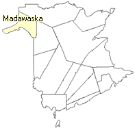
County location in province

 County map showing parishes
 Zoom in

Cadastral Maps
New Brunswick cadastral maps show the basic features of the province along with the boundaries, lot number, and grantee’s name for land granted by the province. These maps are cumulative, showing all grants regardless of date.
Zoom in

or
download
the full size version.
2839 x 3948 - 3 mb
|