Place Names of New Brunswick: Where is Home? New Brunswick Communities Past and Present
 Introduction |
  Alphabetical Listing |
  County Listing |
  Indexes |
  Definitions
 Skip Navigation Links
Located 6.09 km SSW of
Dalhousie:
Dalhousie Parish,
Restigouche County: PO
Eel River 1861-1886: PO
Eel River Crossing from 1886: in 1898 Eel River Crossing was a station on the Intercolonial Railway and a farming and lumbering community with 1 post office, 3 stores, 1 hotel, 1 steam sawmill and shingle mill, 1 cheese factory, 1 church and a population of 500: included Millers Crossing or Miller Settlement: also included Stanmore: named for Arthur Charles Hamilton Gordon, 1st Baron Stanmore (1829-1912) and lieutenant-governor of New Brunswick from 1861-1866: PO 1896-1898: in 1904
Stanmore was a settlement with a population of 25: Eel River Crossing was incorporated as a village in 1966.
Latitude
:
48° 1'
Longitude
:
66° 25'
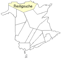
County
:
Restigouche
Parish
:
Dalhousie
County location in province

 County map showing parishes
 Zoom in

Cadastral Maps
New Brunswick cadastral maps show the basic features of the province along with the boundaries, lot number, and grantee’s name for land granted by the province. These maps are cumulative, showing all grants regardless of date.
Zoom in

or
download
the full size version.
2830 x 3647 - 2.8 mb
|