Place Names of New Brunswick: Where is Home? New Brunswick Communities Past and Present
 Introduction |
  Alphabetical Listing |
  County Listing |
  Indexes |
  Definitions
 Skip Navigation Links
Located on the Miramichi Bay, 3.29 km NE of
Baie-Sainte-Anne:
Hardwicke Parish,
Northumberland County: William Francis Ganong identified the Mi'kmaq name for Escuminac as Eskumunaak which means "look-out spot": settled in 1785: PO 1858-1968: in 1866 Escuminac was a farming and fishing community with about 38 families, including 7 McLean families: in 1898 it had 1 post office, 1 store, 1 hotel, 1 lobster factory, 1 church and a population of 150: included
Bransfield and the community of
Lower Escuminac.
Latitude
:
47° 5'
Longitude
:
64° 54'
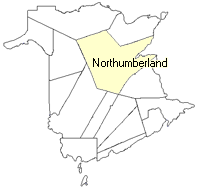
County
:
Northumberland
Parish
:
Hardwicke
County location in province

 County map showing parishes
 Zoom in

Cadastral Maps
New Brunswick cadastral maps show the basic features of the province along with the boundaries, lot number, and grantee’s name for land granted by the province. These maps are cumulative, showing all grants regardless of date.
Zoom in

or
download
the full size version.
3699 x 2758 - 1.7 mb
|