Place Names of New Brunswick: Where is Home? New Brunswick Communities Past and Present
 Introduction |
  Alphabetical Listing |
  County Listing |
  Indexes |
  Definitions
 Skip Navigation Links
Located 7.93 km ENE of
Upper Hainesville:
Bright Parish,
York County: named for Richard Hayne (1804-1874), who was manager of the New Brunswick and Nova Scotia Land Company from 1836-1849: PO from 1867: in 1866 Lower Hainesville was a farming community with approximately 13 resident families, including the families of William Hains, Robert Hains, Joseph Hains and Charles Hains: in 1871 it had a population of about 100: in 1898 Lower Hainesville had 1 post office, 1 store, 1 church and a population of 125.
Latitude
:
46° 6'
Longitude
:
67° 3'
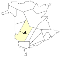
County
:
York
Parish
:
Bright
County location in province

 County map showing parishes
 Zoom in

Cadastral Maps
New Brunswick cadastral maps show the basic features of the province along with the boundaries, lot number, and grantee’s name for land granted by the province. These maps are cumulative, showing all grants regardless of date.
Zoom in

or
download
the full size version.
3688 x 2739 - 2 mb
|