Place Names of New Brunswick: Where is Home? New Brunswick Communities Past and Present
 Introduction |
  Alphabetical Listing |
  County Listing |
  Indexes |
  Definitions
 Skip Navigation Links
Located on the St. John River, 3.71 km S of
Simonds:
Simonds Parish,
Carleton County: PO 1852-1913: included McCafferty Settlement: in 1866 McCafferty Settlement was a farming community with approximately 12 families including the families of Dennis McCafferty and John McCafferty: included Palmer Settlement: in 1866 Palmer Settlement was a farming community with 22 families including the families of Jacob Palmer, Leonard Palmer, Marcus Palmer, Thomas Palmer and William Palmer: also included Prosser Settlement: in 1866 Prosser Settlement was a farming community with 6 families including the family of Silas Prosser: in 1866 Middle Simonds was a farming settlement with about 56 resident families: in 1871 Middle Simonds and the surrounding district had a population of 450: in 1898 Middle Simonds had 1 post office, 1 store, 3 churches and a population of 200.
Latitude
:
46° 18'
Longitude
:
67° 33'
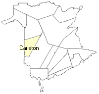
County
:
Carleton
Parish
:
Simonds
County location in province

 County map showing parishes
 Zoom in

Cadastral Maps
New Brunswick cadastral maps show the basic features of the province along with the boundaries, lot number, and grantee’s name for land granted by the province. These maps are cumulative, showing all grants regardless of date.
Zoom in

or
download
the full size version.
3694 x 2760 - 2.5 mb
|