Place Names of New Brunswick: Where is Home? New Brunswick Communities Past and Present
 Introduction |
  Alphabetical Listing |
  County Listing |
  Indexes |
  Definitions
 Skip Navigation Links
Located on the Bay of Chaleur, 6.21 km SW of
Pokeshaw, on the road to
Stonehaven:
New Bandon Parish,
Gloucester County: settled in 1819 by several families from Bandon, County Cork, Ireland: PO 1850-1913: in 1866 New Bandon was a farming settlement with about 50 families: in 1871 it had a population of 125: in 1898 New Bandon was a port of entry, a flag station on the Caraquet and Gulf Shore Railway and a settlement with 1 post office, 1 store, 1 hotel, 1 lobster factory, 1 church and a population of 250.
Latitude
:
47° 45'
Longitude
:
65° 19'
County
:
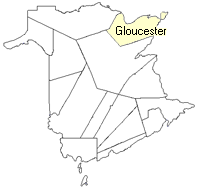
Gloucester
Parish
:
New Bandon
County location in province

 County map showing parishes
 Zoom in

Cadastral Maps
New Brunswick cadastral maps show the basic features of the province along with the boundaries, lot number, and grantee’s name for land granted by the province. These maps are cumulative, showing all grants regardless of date.
Zoom in

or
download
the full size version.
3821 x 2776 - 2.4 mb
|