Place Names of New Brunswick: Where is Home? New Brunswick Communities Past and Present
 Introduction |
  Alphabetical Listing |
  County Listing |
  Indexes |
  Definitions
 Skip Navigation Links
Located 3.93 km SSE of
Hoyt and 5.38 km NW of
Wirral:
Blissville Parish,
Sunbury County and
Petersville Parish,
Queens County: Walter Patterson, William Patterson and Andrew Patterson, from County Donegal, Ireland, settled here about 1840: PO 1866-1915: in 1898 Patterson Settlement had 1 post office, 1 church and a population of 75: Patterson Settlement became part of Hoyt.
Latitude
:
45° 33'
Longitude
:
66° 32'
County
:
Sunbury
Parish
:
Blissville
County location in province

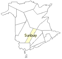 County map showing parishes
 Zoom in

Cadastral Maps
New Brunswick cadastral maps show the basic features of the province along with the boundaries, lot number, and grantee’s name for land granted by the province. These maps are cumulative, showing all grants regardless of date.
Zoom in

or
download
the full size version.
3572 x 2735 - 2.3 mb
|