Place Names of New Brunswick: Where is Home? New Brunswick Communities Past and Present
 Introduction |
  Alphabetical Listing |
  County Listing |
  Indexes |
  Definitions
 Skip Navigation Links
Located on
Shippegan Island, 2.49 km E of
Sainte-Cécile, on the road to
Little Shippegan:
Shippegan Parish,
Gloucester County: PO
Island River 1893-1950: in 1898 Island River was a farming and fishing settlement with 1 post office, 1 store, 1 hotel, 1 lobster factory, 1 church and a population of 175: PO
Petite-Rivière-de-l'Ile 1950-1959: PO
Petite-Rivière-de-l'Isle from 1959.
Latitude
:
47° 52'
Longitude
:
64° 38'
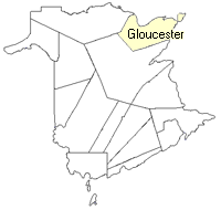
County
:
Gloucester
Parish
:
Shippegan
County location in province

 County map showing parishes
 Zoom in

Cadastral Maps
New Brunswick cadastral maps show the basic features of the province along with the boundaries, lot number, and grantee’s name for land granted by the province. These maps are cumulative, showing all grants regardless of date.
Zoom in

or
download
the full size version.
2849 x 3850 - 2.9 mb
|