Place Names of New Brunswick: Where is Home? New Brunswick Communities Past and Present
 Introduction |
  Alphabetical Listing |
  County Listing |
  Indexes |
  Definitions
 Skip Navigation Links
Located 5.03 km W of
Verret:
Saint-Hilaire Parish and
Baker Brook Parish,
Madawaska County: established in 1872: possibly named for Francis Rice, Member of the Legislative Assembly for Madawaska from 1850-1855: included the community of Colin: PO
Colin 1909-1951 with Edward Colin as first postmaster: included the settlement of Ouellette.
Latitude
:
47° 21'
Longitude
:
68° 27'
County
:
Madawaska
Parish
:
Saint-Hilaire
County location in province

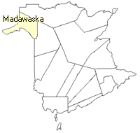 County map showing parishes
 Zoom in

Cadastral Maps
New Brunswick cadastral maps show the basic features of the province along with the boundaries, lot number, and grantee’s name for land granted by the province. These maps are cumulative, showing all grants regardless of date.
Zoom in

or
download
the full size version.
3769 x 2982 - 3.2 mb
|