Place Names of New Brunswick: Where is Home? New Brunswick Communities Past and Present
 Introduction |
  Alphabetical Listing |
  County Listing |
  Indexes |
  Definitions
 Skip Navigation Links
Located 7.86 km SSW of
Rothesay and 5.71 km NNE of
Saint John:
Simonds Parish,
St. John County: may have first been called Moosepath: renamed Three Mile House when post office was created: PO
Three Mile House 1875-1889: renamed Cold Brook in 1889: PO
Cold Brook 1889-1905: in 1898 Coldbrook was a station on the Intercolonial Railway and a farming community with 2 stores, rolling mills, a trotting park and a population of 50: PO
Coldbrook 1905-1959: now within the city of Saint John.
Latitude
:
45° 19'
Longitude
:
66° 2'
County
:
St. John
Parish
:
Simonds
County location in province

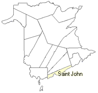 County map showing parishes
 Zoom in

Cadastral Maps
New Brunswick cadastral maps show the basic features of the province along with the boundaries, lot number, and grantee’s name for land granted by the province. These maps are cumulative, showing all grants regardless of date.
Zoom in

or
download
the full size version.
4912 x 3485 - 3.5 mb
|