Place Names of New Brunswick: Where is Home? New Brunswick Communities Past and Present
 Introduction |
  Alphabetical Listing |
  County Listing |
  Indexes |
  Definitions
 Skip Navigation Links
Located 3.92 km NNE of
Rivière-Verte and 3.92 km SSW of
Montagne-des-Therrien:
Rivière-Verte Parish,
Madawaska County: first called Lavoie Settlement which in 1927 was a post office: included the community of
Thibodeau: Olivier Thibodeau, Jean-Baptiste Thibodeau, Joseph Thibodeau and Etienne Thibodeau settled here about 1790: PO
Thibodeau 1927-1962 with P.M. Thibodeau as first postmaster.
Latitude
:
47° 21'
Longitude
:
68° 8'
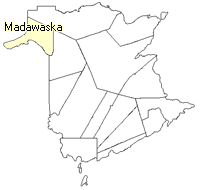
County
:
Madawaska
Parish
:
Rivière-Verte
County location in province

 County map showing parishes
 Zoom in

Cadastral Maps
New Brunswick cadastral maps show the basic features of the province along with the boundaries, lot number, and grantee’s name for land granted by the province. These maps are cumulative, showing all grants regardless of date.
Zoom in

or
download
the full size version.
3769 x 2982 - 3.2 mb
|