Place Names of New Brunswick: Where is Home? New Brunswick Communities Past and Present
 Introduction |
  Alphabetical Listing |
  County Listing |
  Indexes |
  Definitions
 Skip Navigation Links
Located on the Chaleur Bay, 8.92 km WSW of
Bas-Caraquet:
Caraquet Parish,
Gloucester County: William Francis Ganong identifed the Mi'kmaq name for Caraquet as Kalagee: PO from 1850: Founded by Acadians: in 1898 Caraquet was a seaport and sub-port of entry on the Caraquet and Gulf Shore Railway and a farming and fishing community with 14 stores, 3 hotels, 2 lumber mills, 2 lobster factories, 1 tannery, 5 codfish plants, 1 university, 1 convent, 2 churches and a population of 2,500: included
Le Bouthillier, located 3 km E of Caraquet, the community of
Sainte-Anne-du-Bocage, located 5 km W of Caraquet: PO
Sainte-Anne-du-Bocage 1919-1970: Also included the community of
Pointe-Rocheuse: the town of Caraquet was incorporated in 1961.
Latitude
:
47° 47'
Longitude
:
64° 57'
County
:
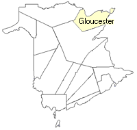
Gloucester
Parish
:
Caraquet
County location in province

 County map showing parishes
 Zoom in

Cadastral Maps
New Brunswick cadastral maps show the basic features of the province along with the boundaries, lot number, and grantee’s name for land granted by the province. These maps are cumulative, showing all grants regardless of date.
Zoom in

or
download
the full size version.
3707 x 2785 - 2.9 mb
|