Place Names of New Brunswick: Where is Home? New Brunswick Communities Past and Present
 Introduction |
  Alphabetical Listing |
  County Listing |
  Indexes |
  Definitions
 Skip Navigation Links
Located on N side of the Miramichi River, 2.53 km W of
Chatham and 3.13 km NE of
Nordin:
Newcastle Parish,
Northumberland County: first called Gretna Green for the name of a town in Scotland: renamed Douglastown to mark an official visit by Sir Howard Douglas (1776-1861) who was lieutenant-governor of New Brunswick from 1823-1832: PO from 1835: in 1866 Douglastown was a farming, fishing and lumbering community with approximately 82 families: in 1871 Douglastown had a population of 400: in 1898 it had 1 post office, 6 stores, 1 hotel, 2 sawmills, 2 churches and a population of 600: Douglastown was incorporated as a village in 1966: Douglastown became part of the city of
Miramichi.
Latitude
:
47° 2'
Longitude
:
65° 30'
County
:
Northumberland
Parish
:
Newcastle
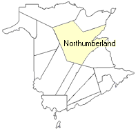
County location in province

 County map showing parishes
 Zoom in

Cadastral Maps
New Brunswick cadastral maps show the basic features of the province along with the boundaries, lot number, and grantee’s name for land granted by the province. These maps are cumulative, showing all grants regardless of date.
Zoom in

or
download
the full size version.
3763 x 2726 - 2.5 mb
|