Place Names of New Brunswick: Where is Home? New Brunswick Communities Past and Present
 Introduction |
  Alphabetical Listing |
  County Listing |
  Indexes |
  Definitions
 Skip Navigation Links
Located on E side of the Petitcodiac River, 2.57 km E of
Moncton and 2.26 km NW of
Chartersville:
Moncton Parish,
Westmorland County: first known as Léger, Légère or Légère Corner, located 1.5 km N of present-day Dieppe: PO
Legere Corner 1896-1930: PO
Leger Corner 1930-1946: in 1898 Legere Corner was a farming settlement with 1 post office, 1 store and a population of 100: also included
Lakeburn, located 5 km E of Dieppe: PO 1882-1960: in 1898 Lakeburn was a farming community with 1 post office, 1 church and a population of 150: renamed Dieppe in 1946 in honour of Canadians who fell at the Battle of Dieppe in France on August 19, 1942: PO
Dieppe 1946-1960: Dieppe was incorporated as a village in 1946 and as a town in 1952.
Latitude
:
46° 6'
Longitude
:
64° 45'
County
:
Westmorland
Parish
:
Moncton
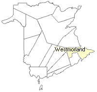
County location in province

 County map showing parishes
 Zoom in

Cadastral Maps
New Brunswick cadastral maps show the basic features of the province along with the boundaries, lot number, and grantee’s name for land granted by the province. These maps are cumulative, showing all grants regardless of date.
Zoom in

or
download
the full size version.
3650 x 2713 - 2.6 mb
|