Place Names of New Brunswick: Where is Home? New Brunswick Communities Past and Present
 Introduction |
  Alphabetical Listing |
  County Listing |
  Indexes |
  Definitions
 Skip Navigation Links
Located in the west part of
Saint John:
Lancaster Parish,
St. John County: first called Mahogany Road and then Fairville for Robert Fair (1824-1901), a local merchant: PO
Fairville 1864-1947 with James Ready as the postmaster: in 1866 Fairville had about 45 resident families: in 1871 Fairville had a population of 1,500 and was the eastern terminus of the European and North American Railway: in 1898 Fairville was a station on the Canadian Pacific Railway, a lumbering and manufacturing village with 1 post office, 25 stores, 2 hotels, 1 brewery, 1 sawmill, 1 pulp mill, 2 carriage factories, a provincial lunatic asylum, 5 churches and a population of 1,500: in 1871 Lancaster had a population of 200: the name of the whole community was changed to Lancaster in the 1940's: also included Lancaster Vale: Lancaster became part of
Saint John.
Latitude
:
45° 15'
Longitude
:
66° 6'
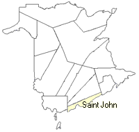
County
:
St. John
Parish
:
Lancaster
County location in province

 County map showing parishes
 Zoom in

Cadastral Maps
New Brunswick cadastral maps show the basic features of the province along with the boundaries, lot number, and grantee’s name for land granted by the province. These maps are cumulative, showing all grants regardless of date.
Zoom in

or
download
the full size version.
4912 x 3485 - 3.5 mb
|