Place Names of New Brunswick: Where is Home? New Brunswick Communities Past and Present
 Introduction |
  Alphabetical Listing |
  County Listing |
  Indexes |
  Definitions
 Skip Navigation Links
Located 5.51 km ENE of
Southfield, on the road to
Upper Wards Creek:
Sussex Parish,
Kings County: possibly named for battles fought against the British at Vinegar Hill, near Wexford, Ireland, during the 1798 rebellion against British rule: settled by Irish immigrants: Vinegar Hill included the settlement of
Poodiac.
Latitude
:
45° 37'
Longitude
:
65° 33'
County
:
Kings
Parish
:
Sussex
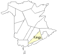
County location in province

 County map showing parishes
 Zoom in

Cadastral Maps
New Brunswick cadastral maps show the basic features of the province along with the boundaries, lot number, and grantee’s name for land granted by the province. These maps are cumulative, showing all grants regardless of date.
Zoom in

or
download
the full size version.
3718 x 2931 - 2.9 mb
|