Place Names of New Brunswick: Where is Home? New Brunswick Communities Past and Present
 Introduction |
  Alphabetical Listing |
  County Listing |
  Indexes |
  Definitions
 Skip Navigation Links
Located on the St. John River, 2.61 km W of
Ingleside, on the road to
Ononette:
Westfield Parish,
Kings County: originally called Ballentine: PO 1888-1889 with R. Ballentine as the first postmaster: renamed Westfield Centre in 1889: PO 1889-1957: in 1898 Westfield Centre was a farming settlement with 1 post office, 1 store, 1 sawmill and a population of 75: became part of the village of
Westfield.
Latitude
:
45° 20'
Longitude
:
66° 14'
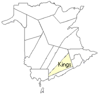
County
:
Kings
Parish
:
Westfield
County location in province

 County map showing parishes
 Zoom in

Cadastral Maps
New Brunswick cadastral maps show the basic features of the province along with the boundaries, lot number, and grantee’s name for land granted by the province. These maps are cumulative, showing all grants regardless of date.
Zoom in

or
download
the full size version.
3678 x 2934 - 2.5 mb
|