Place Names of New Brunswick: Where is Home? New Brunswick Communities Past and Present
 Introduction |
  Alphabetical Listing |
  County Listing |
  Indexes |
  Definitions
 Skip Navigation Links
Located 7.42 km S of
Chipman, on the road to
The Range:
Chipman Parish,
Queens County: settled about 1829: William Francis Ganong identified the Maliseet name for this area as Meagos'guelk: PO 1874-1970: in 1866 Coal Creek was a farming settlement with approximately 9 resident families, including 6 Lecky families: in 1898 Coal Creek had 1 post office and a population of 50: the Canadian Pacific Railway station located 1.5 km S of Coal Creek was called
Pennlyn.
Latitude
:
46° 6'
Longitude
:
65° 53'
County
:
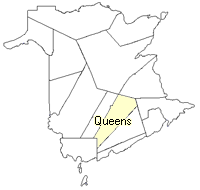
Queens
Parish
:
Chipman
County location in province

 County map showing parishes
 Zoom in

Cadastral Maps
New Brunswick cadastral maps show the basic features of the province along with the boundaries, lot number, and grantee’s name for land granted by the province. These maps are cumulative, showing all grants regardless of date.
Zoom in

or
download
the full size version.
3780 x 2705 - 2.9 mb
|