Place Names of New Brunswick: Where is Home? New Brunswick Communities Past and Present
 Introduction |
  Alphabetical Listing |
  County Listing |
  Indexes |
  Definitions
 Skip Navigation Links
Located on W side of the St. John River, E of the
Kingsclear First Nation, Pilick and 9.83 km NE of
Kingsclear:
Kingsclear Parish,
York County: named for the Acadians who settled here in the late 1700's: the majority of these settlers moved to
Madawaska when the Loyalists arrived in 1784: in 1904 French Village was a farming settlement with 1 church and a population of 100: the Canadian National Railway station here was called
Macnaquac: French Village became part of Kingsclear.
Latitude
:
45° 57'
Longitude
:
66° 50'
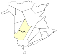
County
:
York
Parish
:
Kingsclear
County location in province

 County map showing parishes
 Zoom in

Cadastral Maps
New Brunswick cadastral maps show the basic features of the province along with the boundaries, lot number, and grantee’s name for land granted by the province. These maps are cumulative, showing all grants regardless of date.
Zoom in

or
download
the full size version.
3652 x 2733 - 2.8 mb
|