Place Names of New Brunswick: Where is Home? New Brunswick Communities Past and Present
 Introduction |
  Alphabetical Listing |
  County Listing |
  Indexes |
  Definitions
 Skip Navigation Links
Located on N side of the Southwest Miramichi River, 2.25 km NE of
Renous:
Derby Parish,
Northumberland County: PO
Renous Bridge 1856-1911: in 1866 it was a farming community with approximately 76 resident families, including 11 Donovan families: in 1898 Renous Bridge had 1 post office, 1 store, 1 hotel, 1 church and a population of 100: included Indiantown, which in 1871 had a population of 75: in 1898 Indiantown was a station on the Intercolonial Railway and a farming, lumbering and fishing settlement with 2 stores, 2 hotels, 1 quarry, 1 church, and a population of 150: PO
Quarryville 1911-1970.
Latitude
:
46° 50'
Longitude
:
65° 47'
County
:
Northumberland
Parish
:
Derby
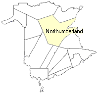
County location in province

 County map showing parishes
 Zoom in

Cadastral Maps
New Brunswick cadastral maps show the basic features of the province along with the boundaries, lot number, and grantee’s name for land granted by the province. These maps are cumulative, showing all grants regardless of date.
Zoom in

or
download
the full size version.
2405 x 1798 - 1.4 mb
|
Zoom in

or
download
the full size version.
2490 x 1800 - 1.1 mb
|