Place Names of New Brunswick: Where is Home? New Brunswick Communities Past and Present
 Introduction |
  Alphabetical Listing |
  County Listing |
  Indexes |
  Definitions
 Skip Navigation Links
Located 2.25 km SE of
Hazeldean and 4.23 km ENE of
Bell Grove:
Gordon Parish,
Victoria County: first called Bungalow Farm: PO
Bungalow Farm 1912-1916: renamed Anfield in 1916: PO
Anfield 1916-1939: included the settlement of Forbes or Forbes Crossing.
Latitude
:
46° 56'
Longitude
:
67° 31'
County
:
Victoria
Parish
:
Gordon
County location in province

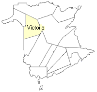 County map showing parishes
 Zoom in

Cadastral Maps
New Brunswick cadastral maps show the basic features of the province along with the boundaries, lot number, and grantee’s name for land granted by the province. These maps are cumulative, showing all grants regardless of date.
Zoom in

or
download
the full size version.
3719 x 2767 - 2.8 mb
|