Place Names of New Brunswick: Where is Home? New Brunswick Communities Past and Present
 Introduction |
  Alphabetical Listing |
  County Listing |
  Indexes |
  Definitions
 Skip Navigation Links
Located on the Chaleur Bay at the mouth of the Restigouche River:
Dalhousie Parish,
Restigouche County: settled in the late 1820's by Scottish emigrants who set up shipbuilding and lumbering industries here: PO from 1831: in 1866 Dalhousie was a village with about 110 resident families: in 1871 it had a population of 600: in 1898 Dalhousie was a port of entry, a station on the Intercolonial Railway, a large salmon and smelt exporter and a community with 1 post office, 10 stores, 3 hotels, 4 steam sawmills, 1 sash and door factory, 1 planing mill, 1 shingle mill, 1 tannery, 3 churches and a population of 1,100: Dalhousie was incorporated as a town in 1905.
Latitude
:
48° 4'
Longitude
:
66° 23'
County
:
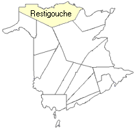
Restigouche
Parish
:
Dalhousie
County location in province

 County map showing parishes
 Zoom in

Cadastral Maps
New Brunswick cadastral maps show the basic features of the province along with the boundaries, lot number, and grantee’s name for land granted by the province. These maps are cumulative, showing all grants regardless of date.
Zoom in

or
download
the full size version.
2830 x 3647 - 2.8 mb
|