Place Names of New Brunswick: Where is Home? New Brunswick Communities Past and Present
 Introduction |
  Alphabetical Listing |
  County Listing |
  Indexes |
  Definitions
 Skip Navigation Links
Located on W bank of the St. John River:
Grand Falls Parish,
Victoria County: William Francis Ganong identified the Maliseet name for Grand Falls as Chikchunikabik: by the mid-1700's the French named the area
Long Sault: renamed Grand Falls: a British military post by 1790: the settlement grew with the development of sawmills in the 1830's: PO from 1837: in 1866 Grand Falls was a community with approximately 55 families: included the settlement of Colebrooke: PO 1851-c1870: in 1871
Colebrooke and the surrounding district had a population of 700: Grand Falls was incorporated as a town in 1890 and in 1904 it was a port of entry, a station on the Canadian Pacific Railway and a town with 15 stores, 3 hotels, 1 sawmill, 1 grist mill, 1 cheese factory, 1 butter factory, 3 churches and a population of 1000.
Latitude
:
47° 3'
Longitude
:
67° 44'
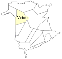
County
:
Victoria
Parish
:
Grand Falls
County location in province

 County map showing parishes
 Zoom in

Cadastral Maps
New Brunswick cadastral maps show the basic features of the province along with the boundaries, lot number, and grantee’s name for land granted by the province. These maps are cumulative, showing all grants regardless of date.
Zoom in

or
download
the full size version.
3817 x 2780 - 2.7 mb
|