Place Names of New Brunswick: Where is Home? New Brunswick Communities Past and Present
 Introduction |
  Alphabetical Listing |
  County Listing |
  Indexes |
  Definitions
 Skip Navigation Links
Located on S side of the Miramichi River, 7.32 km ENE of
Chatham:
Chatham Parish,
Northumberland County: first known as Black Brook for John Black, who settled here about 1780: PO
Black Brook 1861-1895: in 1866 Black Brook was a farming and lumbering settlement with approximately 44 resident families, including 8 Loggie families: Robert Loggie emigrated from Scotland and settled in this area in 1790: three of his brothers, Andrew Loggie, Robert Loggie and Frank Loggie, became prominent businessmen: in 1871 the settlement had a population of 300: renamed Loggieville in 1895: PO
Loggieville from 1895 with Andrew Loggie as first postmaster: in 1898 Loggieville was the deep water terminus of the Canada Eastern Railway and a farming, fishing and manufacturing community with 1 post office, 4 stores, 1 hotel, 1 grist mill, 1 carding mill, 1 canning factory, large freezers, 2 sawmills, 2 churches and a population of 400: in 1898 Loggieville was the largest fresh fish exporting concern in Canada: Loggieville was incorporated as a village in 1966 and later became part of the city of
Miramichi.
Latitude
:
47° 4'
Longitude
:
65° 23'
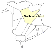
County
:
Northumberland
Parish
:
Chatham
County location in province

 County map showing parishes
 Zoom in

Cadastral Maps
New Brunswick cadastral maps show the basic features of the province along with the boundaries, lot number, and grantee’s name for land granted by the province. These maps are cumulative, showing all grants regardless of date.
Zoom in

or
download
the full size version.
3634 x 2759 - 2.2 mb
|