Place Names of New Brunswick: Where is Home? New Brunswick Communities Past and Present
 Introduction |
  Alphabetical Listing |
  County Listing |
  Indexes |
  Definitions
 Skip Navigation Links
Located on
Grand Manan Island, 4.37 km ENE of
Seal Cove, on the road to
Grand Harbour:
Grand Manan Parish,
Charlotte County: in 1866 it was a fishing community with approximately 12 families: Mark Hill became part of the village of
Grand Harbour.
Latitude
:
44° 40'
Longitude
:
66° 48'
County
:
Charlotte
Parish
:
Grand Manan
County location in province

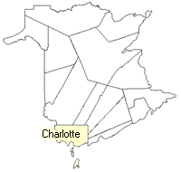 County map showing parishes
 Zoom in

Cadastral Maps
New Brunswick cadastral maps show the basic features of the province along with the boundaries, lot number, and grantee’s name for land granted by the province. These maps are cumulative, showing all grants regardless of date.
Zoom in

or
download
the full size version.
2731 x 3830 - 1.5 mb
|