Place Names of New Brunswick: Where is Home? New Brunswick Communities Past and Present
 Introduction |
  Alphabetical Listing |
  County Listing |
  Indexes |
  Definitions
 Skip Navigation Links
Located on E side of the St. John River, opposite
Kingsclear, 1.85 km S of
Lower Line Queensbury:
Queensbury Parish,
York County: PO
McNallys Ferry 1912-1914 with A.C. McNally as postmaster: the McNallys Ferry operated until 1967: formerly called Mazeralls Ferry: McNallys became part of Lower Line Queensbury.
Latitude
:
45° 54'
Longitude
:
66° 55'
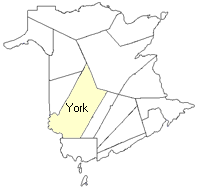
County
:
York
Parish
:
Queensbury
County location in province

 County map showing parishes
 Zoom in

Cadastral Maps
New Brunswick cadastral maps show the basic features of the province along with the boundaries, lot number, and grantee’s name for land granted by the province. These maps are cumulative, showing all grants regardless of date.
Zoom in

or
download
the full size version.
3652 x 2733 - 2.8 mb
|