Place Names of New Brunswick: Where is Home? New Brunswick Communities Past and Present
 Introduction |
  Alphabetical Listing |
  County Listing |
  Indexes |
  Definitions
 Skip Navigation Links
Located 13.04 km N of
Welsford, on the road between
Armstrong Corner and
Cootes Hill:
Petersville Parish,
Queens County: settled around 1820: New Jerusalem is no longer a community as it was located within the area expropriated for
CFB Gagetown.
Latitude
:
45° 34'
Longitude
:
66° 19'
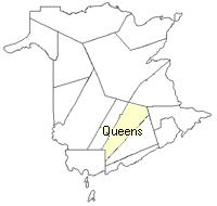
County
:
Queens
Parish
:
Petersville
County location in province

 County map showing parishes
 Zoom in

Cadastral Maps
New Brunswick cadastral maps show the basic features of the province along with the boundaries, lot number, and grantee’s name for land granted by the province. These maps are cumulative, showing all grants regardless of date.
Zoom in

or
download
the full size version.
3549 x 2738 - 1.3 mb
|