Place Names of New Brunswick: Where is Home? New Brunswick Communities Past and Present
 Introduction |
  Alphabetical Listing |
  County Listing |
  Indexes |
  Definitions
 Skip Navigation Links
Located 5.53 km ENE of
Upper Loch Lomond, on the road to
West Quaco:
Simonds Parish,
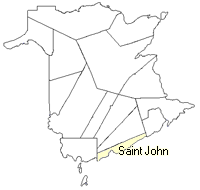
St. John County: PO 1857-1928: in 1866 Quaco Road was a farming community with 45 families: Henry Settlement, which was located nearby, had approximately 9 resident families, including the family of James Henry: Ryan Settlement, which was also nearby, had 9 resident families, including 6 Ryan families: in 1871 Quaco Road had a population of 300: in 1898 Quaco Road had 1 post office, 1 church and a population of 75.
Latitude
:
45° 23'
Longitude
:
65° 46'
County
:
St. John
Parish
:
Simonds
County location in province

 County map showing parishes
 Zoom in

Cadastral Maps
New Brunswick cadastral maps show the basic features of the province along with the boundaries, lot number, and grantee’s name for land granted by the province. These maps are cumulative, showing all grants regardless of date.
Zoom in

or
download
the full size version.
2804 x 3742 - 2.7 mb
|