Place Names of New Brunswick: Where is Home? New Brunswick Communities Past and Present
 Introduction |
  Alphabetical Listing |
  County Listing |
  Indexes |
  Definitions
 Skip Navigation Links
Located 8.99 km W of
Woodstock:
Richmond Parish,
Carleton County: PO
Richmond 1851-1871: PO
Richmond Corner 1871-1918: in 1866 Richmond Corner was a farming community with about 40 families: in 1871 it had a population of 200: in 1898 Richmond Corner had 1 post office, 2 stores, 1 cheese factory, 2 churches and a population of 150: in 1866 Richmond Station, which was located nearby, was a farming and lumbering settlement with approximately 30 resident families: included Woodstock Road Station: PO 1866-1914: in 1898 Woodstock Road Station was a flag station on the Canadian Pacific Railway and a community with 1 post office and a population of 100: also located nearby was Scotch Corner, which was a farming settlement with about 25 resident families in 1866: in 1871 Scotch Corner and the surrounding district had a population of 250.
Latitude
:
46° 9'
Longitude
:
67° 42'
County
:
Carleton
Parish
:
Richmond
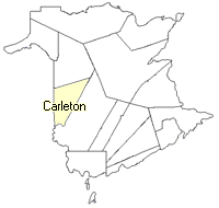
County location in province

 County map showing parishes
 Zoom in

Cadastral Maps
New Brunswick cadastral maps show the basic features of the province along with the boundaries, lot number, and grantee’s name for land granted by the province. These maps are cumulative, showing all grants regardless of date.
Zoom in

or
download
the full size version.
3617 x 2730 - 2.4 mb
|