Place Names of New Brunswick: Where is Home? New Brunswick Communities Past and Present
 Introduction |
  Alphabetical Listing |
  County Listing |
  Indexes |
  Definitions
 Skip Navigation Links
Located 8.8 km E of
Baker Brook, on the road to
Edmundston:
Saint-Hilaire Parish,
Madawaska County: first called Bakers Creek: PO 1848-1873: in 1866 Bakers Creek was a farming settlement with about 53 resident families including 5 Daigle and 9 Long families: renamed in 1873: PO
Saint-Hilaire 1873-1948 and 1968-1970: in 1898 Saint-Hilaire was a station on the Témiscouata Railway and a community with 1 post office, 2 stores, 1 cheese factory, 1 church and a population of 200: included
Albertine which was a settlement named for Victoire Albert: PO 1892-1968: in 1904 Albertine was a settlement with 1 post office, 1 store, 1 cheese factory and a population of 25: Saint-Hilaire was incorporated as a village in 1967.
Latitude
:
47° 18'
Longitude
:
68° 24'
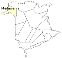
County
:
Madawaska
Parish
:
Saint-Hilaire
County location in province

 County map showing parishes
 Zoom in

Cadastral Maps
New Brunswick cadastral maps show the basic features of the province along with the boundaries, lot number, and grantee’s name for land granted by the province. These maps are cumulative, showing all grants regardless of date.
Zoom in

or
download
the full size version.
3769 x 2982 - 3.2 mb
|