Place Names of New Brunswick: Where is Home? New Brunswick Communities Past and Present
 Introduction |
  Alphabetical Listing |
  County Listing |
  Indexes |
  Definitions
 Skip Navigation Links
Located 15.04 km S of
Kedgwick:
Saint-Quentin Parish,
Restigouche County: originally called
Five Fingers for a nearby brook: renamed Anderson Siding in 1910: PO
Anderson Siding 1912-1919: PO
St-Quentin from 1919: Saint-Quentin: named for the Allied victory against the German troops at Saint-Quentin, France during World War I: was incorporated as a village in 1966 and became a town in 1992.
Latitude
:
47° 31'
Longitude
:
67° 23'
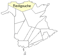
County
:
Restigouche
Parish
:
Saint-Quentin
County location in province

 County map showing parishes
 Zoom in

Cadastral Maps
New Brunswick cadastral maps show the basic features of the province along with the boundaries, lot number, and grantee’s name for land granted by the province. These maps are cumulative, showing all grants regardless of date.
Zoom in

or
download
the full size version.
3669 x 2742 - 2.5 mb
|