Place Names of New Brunswick: Where is Home? New Brunswick Communities Past and Present
 Introduction |
  Alphabetical Listing |
  County Listing |
  Indexes |
  Definitions
 Skip Navigation Links
Located on the Nepisiguit Bay, 11.46 km NE of
Bathurst, on the road to
Janeville:
Bathurst Parish,
Gloucester County: settled about 1820 by Irish immigrants: PO 1861-1913: in 1866 Salmon Beach was a fishing and farming settlement with approximately 65 families, including the families of Abraham Buttimer, Henry R. Buttimer, James Buttimer, Robert Buttimer Sr. and Robert Buttimer Jr.: in 1871 it had a population of about 150: in 1898 Salmon Beach was a flag station on the Caraquet and Gulf Shore Railway and had 1 post office, 1 church and a population of 150: also included
Glen Anglin: PO 1874-1913: in 1898 Glen Anglin was a fishing and farming settlement with 1 post office, 1 sawmill and a population of 200: also included the settlements of Prospect Hill, Strawberry Plain, and Mount Pleasant.
Latitude
:
47° 40'
Longitude
:
65° 32'
County
:
Gloucester
Parish
:
Bathurst
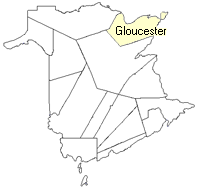
County location in province

 County map showing parishes
 Zoom in

Cadastral Maps
New Brunswick cadastral maps show the basic features of the province along with the boundaries, lot number, and grantee’s name for land granted by the province. These maps are cumulative, showing all grants regardless of date.
Zoom in

or
download
the full size version.
3821 x 2776 - 2.9 mb
|