Place Names of New Brunswick: Where is Home? New Brunswick Communities Past and Present
 Introduction |
  Alphabetical Listing |
  County Listing |
  Indexes |
  Definitions
 Skip Navigation Links
Located at the mouth of the Tay River, 7.53 km N of
Durham Bridge, on the road to
Nashwaak Bridge:
Saint Marys Parish,
York County: the estate of Dugald Campbell was called Taymouth: included the settlement of Nashwaak: PO 1841-1897: in 1866 Nashwaak was a farming community with 100 resident families, including 5 Campbell families, 6 Forbes families, 7 Fraser families, 6 McBane families, 6 Ross families and 6 Young families: in 1871 the community and surrounding district had a population of 200: in 1898 Nashwaak was a flag station on the Canada Eastern Railway and a farming settlement with 1 post office and a population of 30: also included the settlement of Middle Nashwaak: PO
Middle Nashwaak 1898-1904: may have included the settlement of Lionville: PO
Taymouth from 1904.
Latitude
:
46° 11'
Longitude
:
66° 37'
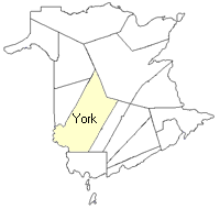
County
:
York
Parish
:
Saint Marys
County location in province

 County map showing parishes
 Zoom in

Cadastral Maps
New Brunswick cadastral maps show the basic features of the province along with the boundaries, lot number, and grantee’s name for land granted by the province. These maps are cumulative, showing all grants regardless of date.
Zoom in

or
download
the full size version.
3628 x 2735 - 2 mb
|