Place Names of New Brunswick: Where is Home? New Brunswick Communities Past and Present
 Introduction |
  Alphabetical Listing |
  County Listing |
  Indexes |
  Definitions
 Skip Navigation Links
Located on N side of the Kouchibouguacis River, 3.15 km NE of
Saint-Ignace:
Saint-Louis Parish,
Kent County: first called False Bay Beach: PO
False Bay Beach 1870-1889: renamed McLeod's Mills: George McLeod and sons operated mills here from 1850-1890: PO
McLeod's Mills 1889-1917: in 1898 McLeod's Mills was a farming and lumbering settlement with 1 post office, 2 stores, 1 sawmill, 1 grist mill, 1 cheese factory and a population of 130: renamed Bretagneville in 1917: PO 1917-1956.
Latitude
:
46° 43'
Longitude
:
65° 3'
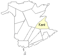
County
:
Kent
Parish
:
Saint-Louis
County location in province

 County map showing parishes
 Zoom in

Cadastral Maps
New Brunswick cadastral maps show the basic features of the province along with the boundaries, lot number, and grantee’s name for land granted by the province. These maps are cumulative, showing all grants regardless of date.
Zoom in

or
download
the full size version.
3671 x 2774 - 2.5 mb
|