Place Names of New Brunswick: Where is Home? New Brunswick Communities Past and Present
 Introduction |
  Alphabetical Listing |
  County Listing |
  Indexes |
  Definitions
 Skip Navigation Links
Located on
Deer Island, 1.85 km S of
Chocolate Cove and 3.93 km SSE of
Fairhaven:
West Isles Parish,
Charlotte County: named for William Cummings, a settler and shipbuilder who arrived here about 1779: PO 1877-1969: in 1904 Cummings Cove was a fishing settlement with 1 post office, 3 stores, 1 church and a population of 150.
Latitude
:
44° 56'
Longitude
:
66° 59'
County
:
Charlotte
Parish
:
West Isles
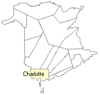
County location in province

 County map showing parishes
 Zoom in

Cadastral Maps
New Brunswick cadastral maps show the basic features of the province along with the boundaries, lot number, and grantee’s name for land granted by the province. These maps are cumulative, showing all grants regardless of date.
Zoom in

or
download
the full size version.
2858 x 3795 - 1.7 mb
|