Place Names of New Brunswick: Where is Home? New Brunswick Communities Past and Present
 Introduction |
  Alphabetical Listing |
  County Listing |
  Indexes |
  Definitions
 Skip Navigation Links
Located 4.5 km SW of
Barnettville:
Blackville Parish,
Northumberland County: PO from 1842: in 1866 Blackville was a lumbering and farming settlement with about 20 families, including 4 Tucker families: in 1871 it had a population of 450: in 1898 Blackville was a station on the Canada Eastern Railway and a junction of the Intercolonial Railway with 1 post office, 5 stores, 2 hotels, 2 sawmills, 1 woodworking factory, 2 churches and a population of 600: included Decantillon's: PO
Decantillon's c1842-1847: also included
Underhill and The Forks: Blackville was incorporated as a village in 1966.
Latitude
:
46° 44'
Longitude
:
65° 50'
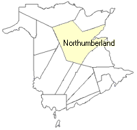
County
:
Northumberland
Parish
:
Blackville
County location in province

 County map showing parishes
 Zoom in

Cadastral Maps
New Brunswick cadastral maps show the basic features of the province along with the boundaries, lot number, and grantee’s name for land granted by the province. These maps are cumulative, showing all grants regardless of date.
Zoom in

or
download
the full size version.
2490 x 1800 - 1.1 mb
|