Place Names of New Brunswick: Where is Home? New Brunswick Communities Past and Present
 Introduction |
  Alphabetical Listing |
  County Listing |
  Indexes |
  Definitions
 Skip Navigation Links
Located 6.38 km SE of
Summer Hill and 1.5 km NE of the boundary line between
Hampstead Parish and
Petersville Parish:
Hampstead Parish,
Queens County: included Sharps Settlement; Mahoods Corner named for Samuel Mahood, surveyor and teacher; Shorts Corner, named for Albert Short; Barnetts Corner named for Robert Barnett; and
West Jerusalem: also included Polleyhurst: PO 1883-1928 with Richard Polley as the first postmaster: in 1898 Polleyhurst was a farming settlement with 1 post office and a population of 50: PO
New Jerusalem 1850-1935: in 1871 New Jerusalem and surrounding district had a population of 250: in 1898 New Jerusalem was a farming community with 1 post office, 2 stores, 2 churches and a population of 125: New Jerusalem is no longer a community as it was located within the area expropriated for
CFB Gagetown.
Latitude
:
45° 35'
Longitude
:
66° 12'
County
:
Queens
Parish
:
Hampstead
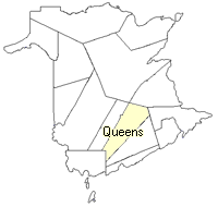
County location in province

 County map showing parishes
 Zoom in

Cadastral Maps
New Brunswick cadastral maps show the basic features of the province along with the boundaries, lot number, and grantee’s name for land granted by the province. These maps are cumulative, showing all grants regardless of date.
Zoom in

or
download
the full size version.
3549 x 2738 - 1.3 mb
|