Place Names of New Brunswick: Where is Home? New Brunswick Communities Past and Present
 Introduction |
  Alphabetical Listing |
  County Listing |
  Indexes |
  Definitions
 Skip Navigation Links
Located on the St. John River, 5.22 km W of
Saint John:
Lancaster Parish,
St. John County: named for Archibald Fitz-Randolph who, along with Charles P. Baker, set up a sawmill and lime burning operation in 1870: PO 1892-1959: in 1898 Randolph was a lumbering community with 1 post office, 1 store, 1 sawmill, 1 large lime kiln, a quarry and a population of 300: included the community of Green Head: in 1871 Green Head had a population of 75: Randolph is now within the city of Saint John.
Latitude
:
45° 16'
Longitude
:
66° 7'
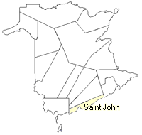
County
:
St. John
Parish
:
Lancaster
County location in province

 County map showing parishes
 Zoom in

Cadastral Maps
New Brunswick cadastral maps show the basic features of the province along with the boundaries, lot number, and grantee’s name for land granted by the province. These maps are cumulative, showing all grants regardless of date.
Zoom in

or
download
the full size version.
4912 x 3485 - 3.5 mb
|