Place Names of New Brunswick: Where is Home? New Brunswick Communities Past and Present
 Introduction |
  Alphabetical Listing |
  County Listing |
  Indexes |
  Definitions
 Skip Navigation Links
Located on S side of the Southwest Miramichi River, 3.83 km E of
Taxis River:
Ludlow Parish,
Northumberland County: named for Thomas Boies who came from the United States about 1822 to set up a sawmill and grist mill: pronounced "boyce-town": PO from 1842: in 1866 Boiestown was a farming and lumbering settlement with about 46 families: in 1871 it had a population of 250: in 1898 Boiestown had 1 post office, 4 stores, 1 hotel, 1 sawmill, 1 grist mill, 2 churches and a population of 400.
Latitude
:
46° 27'
Longitude
:
66° 25'
County
:
Northumberland
Parish
:
Ludlow
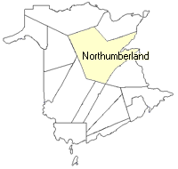
County location in province

 County map showing parishes
 Zoom in

Cadastral Maps
New Brunswick cadastral maps show the basic features of the province along with the boundaries, lot number, and grantee’s name for land granted by the province. These maps are cumulative, showing all grants regardless of date.
Zoom in

or
download
the full size version.
3764 x 2718 - 2 mb
|