Place Names of New Brunswick: Where is Home? New Brunswick Communities Past and Present
 Introduction |
  Alphabetical Listing |
  County Listing |
  Indexes |
  Definitions
 Skip Navigation Links
Located on W side of the St. John River, 3.71 km S of
Woodstock, on the road to
Meductic:
Woodstock Parish,
Carleton County: included the communities of Cedar Hill and Spur Settlement: in 1866 Spur Settlement was a farming community that included the families of James Spur, John Spur, Robert Spur Sr. and Robert Spur Jr.: PO
Lower Woodstock 1859-1913: in 1866 it was a farming settlement with about 35 families: in 1871 Lower Woodstock and surrounding district had a population of 500: in 1904 Lower Woodstock had 1 post office and a population of 100: today Lower Woodstock is within the town of Woodstock.
Latitude
:
46° 7'
Longitude
:
67° 35'
County
:
Carleton
Parish
:
Woodstock
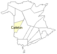
County location in province

 County map showing parishes
 Zoom in

Cadastral Maps
New Brunswick cadastral maps show the basic features of the province along with the boundaries, lot number, and grantee’s name for land granted by the province. These maps are cumulative, showing all grants regardless of date.
Zoom in

or
download
the full size version.
3617 x 2730 - 2.4 mb
|