Place Names of New Brunswick: Where is Home? New Brunswick Communities Past and Present
 Introduction |
  Alphabetical Listing |
  County Listing |
  Indexes |
  Definitions
 Skip Navigation Links
Located on the Nackawic River, 3.17 km SW of
Howland Ridge, on the road to
Upper Hainesville:
Southampton Parish,
York County: established about 1860 as a New Brunswick and Nova Scotia Land Company settlement: the first mill was built by a Mr. Hayes: PO from 1866: in 1871 Millville had a population of 300: the area received more settlers after the adoption of the Free Grants Act in 1879: in 1898 Millville was a station on the Canadian Pacific Railway and had 1 post office, 5 stores, 1 hotel, 1 sawmill, 1 cheese factory, 1 carriage factory and a population of 300: Millville was incorporated as a village in 1966.
Latitude
:
46° 8'
Longitude
:
67° 12'
County
:
York
Parish
:
Southampton
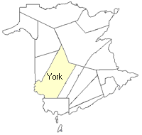
County location in province

 County map showing parishes
 Zoom in

Cadastral Maps
New Brunswick cadastral maps show the basic features of the province along with the boundaries, lot number, and grantee’s name for land granted by the province. These maps are cumulative, showing all grants regardless of date.
Zoom in

or
download
the full size version.
3633 x 2739 - 2.5 mb
|