Place Names of New Brunswick: Where is Home? New Brunswick Communities Past and Present
 Introduction |
  Alphabetical Listing |
  County Listing |
  Indexes |
  Definitions
 Skip Navigation Links
Located 9.36 km N of
Elgin, on the road to
Petitcodiac:
Salisbury Parish,
Westmorland County: William Francis Ganong identified the Mi'kmaq name for Pollett River as Manoosaak': named for Peter Paulet, an early Mi'kmaq leader who lived nearby: PO 1852-1970: included the communities of Forest Glen and Eastman: in 1866 Pollett River was a farming and lumbering settlement with 45 families: in 1871 Pollett River and the surrounding district had a population of 250: in 1898 Pollett River was a station on the Elgin, Petitcodiac and Havelock Railway (Eastman's Station) with 1 post office, 1 store, 1 sawmill, 1 hall and a population of 125.
Latitude
:
45° 53'
Longitude
:
65° 6'
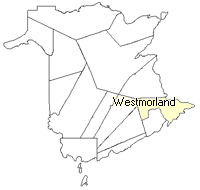
County
:
Westmorland
Parish
:
Salisbury
County location in province

 County map showing parishes
 Zoom in

Cadastral Maps
New Brunswick cadastral maps show the basic features of the province along with the boundaries, lot number, and grantee’s name for land granted by the province. These maps are cumulative, showing all grants regardless of date.
Zoom in

or
download
the full size version.
3743 x 2767 - 2.7 mb
|