Place Names of New Brunswick: Where is Home? New Brunswick Communities Past and Present
 Introduction |
  Alphabetical Listing |
  County Listing |
  Indexes |
  Definitions
 Skip Navigation Links
Located 2.56 km W of
Renauds Mills:
Saint Mary Parish,
Kent County: formerly known as Ohio Settlement: renamed for a Recollet seminary located at Saint-Antoine-de-Padoue in France: PO
St. Anthony 1873-1928: in 1898 it was a station on the Moncton and Buctouche Railway and a farming and lumbering community with 1 post office, 3 stores, 1 church and a population of 300: PO
St -Antoine-de-Kent from 1928: incorporated as the village of St. Anthony in 1966: the name was changed to Saint-Antoine in 1969.
Latitude
:
46° 22'
Longitude
:
64° 45'
County
:
Kent
Parish
:
Saint Mary
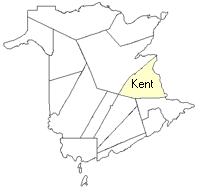
County location in province

 County map showing parishes
 Zoom in

Cadastral Maps
New Brunswick cadastral maps show the basic features of the province along with the boundaries, lot number, and grantee’s name for land granted by the province. These maps are cumulative, showing all grants regardless of date.
Zoom in

or
download
the full size version.
3616 x 2749 - 2.1 mb
|