Place Names of New Brunswick: Where is Home? New Brunswick Communities Past and Present
 Introduction |
  Alphabetical Listing |
  County Listing |
  Indexes |
  Definitions
 Skip Navigation Links
Located on E side of the St. John River, 7.55 km W of
Clair, on the road to
Pelletiers Mill:
Saint-François Parish,
Madawaska County: included Webster's Creek: PO 1857-1874 with Augustin Webster as first postmaster: in 1866 Webster's Creek was a farming community with about 22 resident families: in 1871 it had a population of 100: also included Winding Ledges which was named for the rapids in the St. John River: PO 1874-1900: in 1898 Winding Ledges was a flag station on the Témiscouata Railway (called Ledges) and a settlement with 1 post office, 2 stores, 1 grist mill, 1 cheese factory, 1 church and a population of 200: in 1866 St. Francis was a farming community with about 35 families: PO
St-François-de-Madawaska from 1900: Saint-François-de-Madawaska was incorporated as a village in 1966.
Latitude
:
47° 15'
Longitude
:
68° 42'
County
:
Madawaska
Parish
:
Saint-François
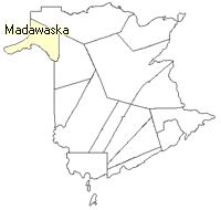
County location in province

 County map showing parishes
 Zoom in

Cadastral Maps
New Brunswick cadastral maps show the basic features of the province along with the boundaries, lot number, and grantee’s name for land granted by the province. These maps are cumulative, showing all grants regardless of date.
Zoom in

or
download
the full size version.
2839 x 3948 - 3 mb
|