Place Names of New Brunswick: Where is Home? New Brunswick Communities Past and Present
 Introduction |
  Alphabetical Listing |
  County Listing |
  Indexes |
  Definitions
 Skip Navigation Links
Located on S side of the Cocagne River, 3.92 km SSE of
Breau-Village, on the road to
Shediac Bridge:
Dundas Parish,
Kent County: settled by Acadians and English: probably named for the Cocagne river, William Francis Ganong identified the Mi'kmaq name as Wijulmacadie, referring to a plant found along the river: PO from 1837: in 1866 Cocagne was a farming community with about 65 families: in 1871 the community and surrounding district had a population of 900: in 1898 Cocagne was a sub-port of entry with 1 post office, 4 stores, 2 hotels, 1 cheese factory, 2 churches and a population of 250.
Latitude
:
46° 20'
Longitude
:
64° 37'
County
:
Kent
Parish
:
Dundas
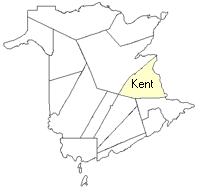
County location in province

 County map showing parishes
 Zoom in

Cadastral Maps
New Brunswick cadastral maps show the basic features of the province along with the boundaries, lot number, and grantee’s name for land granted by the province. These maps are cumulative, showing all grants regardless of date.
Zoom in

or
download
the full size version.
3616 x 2749 - 2.1 mb
|
Zoom in

or
download
the full size version.
3722 x 2775 - 2.8 mb
|