Place Names of New Brunswick: Where is Home? New Brunswick Communities Past and Present
 Introduction |
  Alphabetical Listing |
  County Listing |
  Indexes |
  Definitions
 Skip Navigation Links
Located 2.6 km E of
Patterson:
Petersville Parish,
Queens County: settled about 1826 by Irish immigrants: first known as Adair Settlement and renamed Enniskillen for a town located SW of Omagh in Ireland: in 1871 Enniskillen had a population of 150 and was a station on the European and North American Railway: PO
Enniskillen Station 1870-1882 and from 1883: in 1898 Enniskillen Station was a flag station on the Canadian Pacific Railway and a community with 1 post office, 1 store, 1 hotel and a population of 75: included
Blakely which was located 1.5 km E of Enniskillen: Enniskillen is no longer a community as it was located within the area expropriated for
CFB Gagetown.
Latitude
:
45° 33'
Longitude
:
66° 30'
County
:
Queens
Parish
:
Petersville
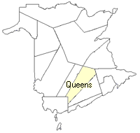
County location in province

 County map showing parishes
 Zoom in

Cadastral Maps
New Brunswick cadastral maps show the basic features of the province along with the boundaries, lot number, and grantee’s name for land granted by the province. These maps are cumulative, showing all grants regardless of date.
Zoom in

or
download
the full size version.
3549 x 2738 - 1.3 mb
|