Place Names of New Brunswick: Where is Home? New Brunswick Communities Past and Present
 Introduction |
  Alphabetical Listing |
  County Listing |
  Indexes |
  Definitions
 Skip Navigation Links
Located on the Belleisle Bay, 1.3 km E of
Hatfield Point and 5.18 km W of
Midland:
Springfield Parish,
Kings County: first called
Belleisle: PO 1882-1895: in 1866 Belleisle was a farming settlement with about 26 families, including 10 Spragg families: in 1898 Keirsteadville had 2 stores and 2 churches: PO
Keirsteadville 1895-1914 with William Kierstead as postmaster: included the settlement of Davis: PO
Davis 1900-1912 with James F. Davis as postmaster.
Latitude
:
45° 39'
Longitude
:
65° 51'
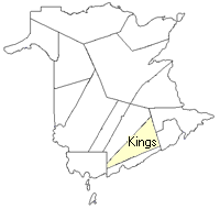
County
:
Kings
Parish
:
Springfield
County location in province

 County map showing parishes
 Zoom in

Cadastral Maps
New Brunswick cadastral maps show the basic features of the province along with the boundaries, lot number, and grantee’s name for land granted by the province. These maps are cumulative, showing all grants regardless of date.
Zoom in

or
download
the full size version.
3680 x 2837 - 2.8 mb
|