Place Names of New Brunswick: Where is Home? New Brunswick Communities Past and Present
 Introduction |
  Alphabetical Listing |
  County Listing |
  Indexes |
  Definitions
 Skip Navigation Links
Located on E side of the St. John River across from
Upper Wicklow, 6.31 km NW of
Bath:
Kent Parish,
Carleton County: first called Bumfrau: PO
Bumfrau 1877-1893: renamed Beechwood in 1893: PO
Beechwood 1893-1947: in 1898 Beechwood was a flag station on the Canadian Pacific Railway and a settlement with 1 post office, 1 store, 1 sawmill, 3 churches and a population of 250: Beechwood is the site of a major hydro-electric development.
Latitude
:
46° 33'
Longitude
:
67° 40'
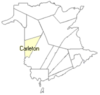
County
:
Carleton
Parish
:
Kent
County location in province

 County map showing parishes
 Zoom in

Cadastral Maps
New Brunswick cadastral maps show the basic features of the province along with the boundaries, lot number, and grantee’s name for land granted by the province. These maps are cumulative, showing all grants regardless of date.
Zoom in

or
download
the full size version.
3610 x 2748 - 2.7 mb
|