Place Names of New Brunswick: Where is Home? New Brunswick Communities Past and Present
 Introduction |
  Alphabetical Listing |
  County Listing |
  Indexes |
  Definitions
 Skip Navigation Links
Located on S side of the Tobique River, 2.54 km W of
Arthurette, on the road to
Currie:
Perth Parish,
Victoria County: settled about 1875 and received additional settlers with the adoption of the Free Grants Act in 1879: PO 1881-1950: in 1898 Red Rapids was a flag station on the Tobique Branch of the Canadian Pacific Railway and a farming settlement with 1 post office, 1 store, 1 hotel, 1 church and a population of about 100: formerly called Baillieville, which was set up about 1830 but later abandoned: named for Thomas Baillie, (1796-1863), the surveyor-general of New Brunswick: also included Leonard Settlement, which was named for several Leonard families who settled in the area.
Latitude
:
46° 47'
Longitude
:
67° 31'
County
:
Victoria
Parish
:
Perth
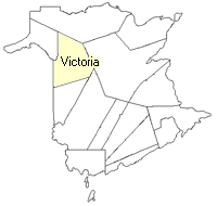
County location in province

 County map showing parishes
 Zoom in

Cadastral Maps
New Brunswick cadastral maps show the basic features of the province along with the boundaries, lot number, and grantee’s name for land granted by the province. These maps are cumulative, showing all grants regardless of date.
Zoom in

or
download
the full size version.
3609 x 2757 - 2.4 mb
|